Start at the bottom of this page, as I've not figured out how to load the images chronologically. (click on images to enlarge)
 A big fire on the way back north was burning west of Chewelah, they had already dispatched a bunch of air tankers.
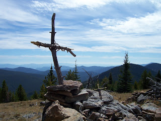
 Somewhere near profanity peak.
 Ryan Creek cabin was our last camp site, it took a while to find any water. The book says 100 yards beyond (it doesn't say follow the trail for another 100 yards, the spring is under the growth to the left of the trail), however, this site is barely used, so the place is overgrown, and it took us about half an hour to find the small water hole. According to what we read this would be the last place with water, since we only had a few quarts left, this was important, since the walk out to Deer Creek summit was another 9 plus miles, excluding the half a mile or so steep trail back up to the main trail.
On the west side of Lambert Mt.


Most springs wer protected from cow trampling by putting fencing around it, with a pipe emptying out in a trough.

 Midnight Mt, we passed the old stage coach trail that went through the pass.
Lots of burned area, with fireweed. No huckleberries on the whole trail, must be too dry near the crest.

 No problem finding springs (see above), even though the ranger station at Kettle Falls said there everything was dried up on the 30 plus mile trial. (The Republic ranger station had better info on this trail)This was not the case, while we were prudent to have at least 3 Liters with us at most times, the only point after which there was no more water was about a mile and a half past the Ryan Creek cabin, old trail 30 junction. There were two trickles after this junction, the third trickle in the next valley filled up our pan within about a minute, so pretty good. After that there was nothing for the next 6-7 miles to Deer Creek Summit.
 Click above to view a large version of the panorama
 Above, Jungle hill in the foreground, Columbia Mt in the background, taken from Wapaloosi Mt
 Above, Sunrise

First campsite above, with sunset
 Mike is a great hiking partner.
 White Mountain behind Sherman Peak.
 Starting up from Sherman Pass, up the north side of Columbia Mountain, you can see above the view towards Sherman Peak.
 The hail was bigger than I have ever seen.
 This image above is the night before about 30 minutes after the thunderstorm passed over our house in southwest Spokane.


No comments:
Post a Comment